Thursday 31 March 2016

Mildura Day 2

Today we went to Merbein Common which encompasses  diverse  landscapes  including  riverine  vegetation,  billabongs   and  small  patches  of  Native  Pine.  Hardy  Black  Box  and  tranquil  River  Red  Gums  are  abundant   along  with  many  fish,  birds  and  animals  that  utilise  this  vegetation  for  protection  and  shelter.

This timber jinker was used for log haulage as thousands of tons of timber were needed to fuel the paddle steamers and pumping station.


This pump constructed in 1914 in Castlemaine by Thompson & Co was used to pump water here until 1959.


Chaffey Landing, named after WB Chaffey who built the winery/distillery on the cliff above in 1913, is on the eastern boundary of the Merbein Common. This access point enabled paddle steamers, going downstream to Morgan, to be loaded with grape spirit that was then taken by train to Adelaide. ‘Bag Town’, on Chaffey Landing, is as an early river bank (makeshift) settlement. 


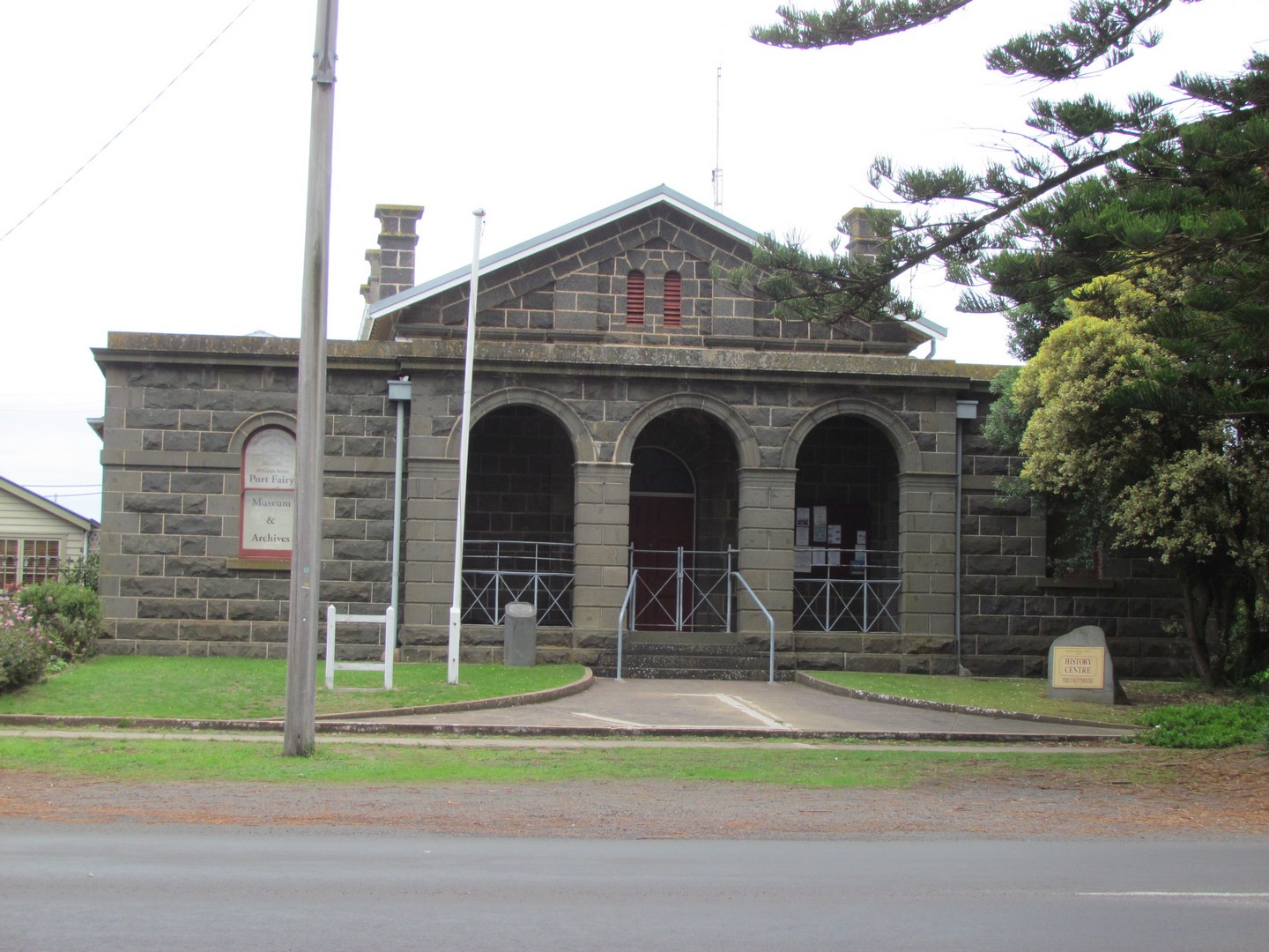
Merbein was originally identified as White Cliffs when the town established because of its impressive river white cliffs. The post office opened on 16 August 1909. The town's name was intended to be "Merebin", which is the Aboriginal word for "white sandcliffs", but an error made when registering the name corrupted it to "Merbein". In 1912 the irrigation settlement's name was officially changed to Merbein, reputedly an aboriginal name of a local sand hill.


The Merbein Lookout walk highlights an old Canoe Tree, this Red River Gum with it's 5 metre long scar bears the marks of the removal of the timber by Aboriginal people to make a canoe. Radiocarbon dating shows the bark was removed 280 years ago, one of many scarred trees found along the Murray River.


The Murray Darling Junction where Australia's two greatest and longest rivers, the Murray and the Darling meet - an iconic Australian 'must see'. A significant meeting, trading and corroboree site for Aboriginal nations.

Wentworth is sited on the junction of the Darling and the Murray rivers in the Murray Basin. The Darling has its headwaters and tributaries fed by monsoonal downpours and mountain rains in north-eastern New South Wales and southern Queensland. It meanders over the imperceptibly sloping plain, but when in flood becomes an inland sea. From the junction it extends some 1900 km, in a good season, to Walgett.

The confluence of the Murray and Darling Rivers, which, combined, is the fourth largest river system in the world. When the Darling is in flow, a surprise awaits - as the two rivers are marked by a distinct colour difference, due to the drought conditions this was not viewable today . The Darling is a clay based river, its milky appearance contrasts starkly to that of the mighty Murray.


Here we saw another of the scarred trees used to make an Aboriginal Canoe. To make a canoe, the aborigines would first make an outline of the shape they required with cutting stones or stone tools. Once the shape was mastered, they cut deeply into the tree to the heartwood (or xylem), prying the bark off in one piece with stick or rocks.


Kevin standing on the far end of Junction Island a shoal of land between the Darling and Murray Rivers. The junction sandbar is where a large number of aborigines, armed with spears and weapons, threatened Captain Sturt as he sailed down the Murray on his expedition to find the inland sea, and here he had arrived at the Darling junction, on 23rd Jan 1830. The confrontation was averted when a group of Aboriginals, who had befriended Captain Sturt the day before, arrived and amicably resolved the stand-off.


We drove into Wentworth and to Fotherby Park.

The Paddle Steamer Ruby was built at Morgan by David Milne in 1907 for Captain Hugh King. She was the fourth riverboat of that name to be used on the Murray. Her owner had also another vessel called Ruby but of 1876 vintage. On acquiring the new steamer he had the old Ruby converted into a barge, renamed her Radia in October 1908 and used her to transport sheep and cattle.

The new Ruby was 205 tons gross, 132'9" in length and had a beam of 18'9". Ruby was built with a whaleboat stern, a straight stem and was carvel design. The depth of the hull was 6 feet, and she was of light draught drawing only between 2'6" and 3' when fully laden with around 85 tons. This enabled her to operate on much lower river levels when other steamers were tied up.

Ruby carried 30 passengers in style and comfort. She had three decks, the top deck featured the wheelhouse, chimney stack and Captain and Mate's quarters. Later in her career female crew quarters and a music room were added. The second deck housed the passengers, saloon and bathrooms. The lower or cargo deck contained the Engineers cabin, gallery and crew quarters. The Ruby proved to be a valuable member of the fleet and she was transferred from one route to another depending on the water in the rivers. Ruby travelled the Morgan to Swan Hill route for most of here working life. She was a 'bottom ender' in every respect and never ventured further up the river because of her length.


McClymonts Cottage Wentworth's First Court House is made out of drop slab construction and is now standing in the park although it originally stood in Darling Street facing Darling Lane. It was dismantled and rebuilt in its present site at Fotherby Park as a Wentworth Rotary Club project. This building was also used as a residence for Wentworth's first Police Sargent in 1860 and it was used as a Court House.

A 1900's 8HP steam engine called 'The Demon'.


Built in 1929, Lock 10 plays an important role in the Murray-Darling water system. The purpose of the weir is both to maintain a high level of water for irrigation in times of little and to regulate water flow. The lock enables boats to pass from the upper stream to down stream level of the Murray River and vice versa.

To allow the migration of fish species upstream past the weir at anytime, special ’fishways’ have been built at the abutments of Lock 10. A series of interconnected pools allow the fish to move from pool to pool as part of their upstream travel. This is an important step in the long term recovery of the Murray River ecology.
Looking back at Junction Island from Lock 10.


National Trust Listed, and still in use for Local Court Sessions the Wentworth Court House was opened on 13 April, 1880. It took the place of a smaller brick building further up Darling Street, but in the same town block.

Made from the local clay bricks, it is a magnificent building that has stood the test of time and provides an excellent example of Pioneer Architecture and Design. The Court House has been restored and the original picket fence replaced.

In 1860 a Post Office established in Wentworth in a shed in Darling Street. Four mail routes converged on Wentworth in 1861, with the mail to Melbourne taking up to 4 ½ days to reach its destination. The first telegram was made available in the settlement in 1866.
The first Post Office was established at Pooncarie in 1869, in a room in the "Pooncaira" Hotel. Mail was delivered to the stations along specified routes via horseback or horse drawn carriages. The present Post Office was built in 1899.


This building served as a navigation company from 1882 onwards, when the rivers were the highways, and has since been service station, butchery etc. After being empty for a few years it came to life with local food and wines.

The Wentworth police Watch-house or 'lock-up' used to confine prisoners with sentences of fourteen days or less was proclaimed to be a prison on 1 December 1870. Some necessary improvements to prisoner accommodation were effected during 1877 after which the Gaol was reported to house three separated and nine associated prisoners.

The small single storey brick gaol with bluestone trim was designed by colonial architect James Barnet and built between 1879 and 1881. It was one of the earliest Australian – designed gaols together with Hay Gaol (1880), Dubbo Gaol (1871) and Long Bay Gaol (1909 and 1914). The bricks were made on-site from the local clay, by Joseph Fritz, and the bluestone was transported from Malmsbury VIC.

When the Prisons Act, 1899 (NSW) was enacted, Wentworth Gaol was one of those listed in the second schedule as existing 'public gaols, prisons or houses of correction'. The Goal closed in 1928. The two final prisoners who had been sentenced on 9 February 1928 were transferred to the Broken Hill Gaol on 27 February 1928, which is possibly the official date of closure. The gaol was officially de-established as a prison on 1 July 1928. Wentworth Gaol was temporarily re-used in 1962 when riots in Mildura prompted the need to utilise the cells at Wentworth.


We then drove to Red Cliffs. No matter where you drive in the Sunraysia Region there are more vineyards than you can imagine, even coming from the Hunter Valley and wine making region, I am shocked at the extent of grape vines that continue for literally kilometre after kilometre.

The name Sunraysia is derived from a contest that entrepreneur Jack De Garis held as part of a promotion in 1919 on behalf of the Australian Dried Fruits Association. The public were invited to submit a name which described the dried fruits grown in the Mildura district. The winning name was Sun-Raysed, and this was extended to describe the district as Sunraysia. De Garis's 1920 established newspaper Sunraysia Daily borrowed the name accordingly.

The season for fresh grapes runs for six to seven months. It starts in November, peaks in February and March and closes in May. Warm, dry summers and deep, rich soils provide the perfect environment for Australian growers to produce world class table grapes. Green, red and blue/black varieties of table grapes come from the major growing regions of Sunraysia and the Murray Valley in Victoria, the Riverina in NSW and south-eastern Queensland.


The do also grow rock melon as we show here and citrus is also a major industry here.


Big Lizzie is a 45-tonne machine that was brought to Mildura in 1918 to clear mallee scrub. It is the only one of its type in the world, with its unique wheel traction and carrying capacity of 80 tonnes. Big Lizzie was standing proud in Barclay Square in the centre of the township of Red Cliffs.


We then went for a walk to see the red cliffs …the area is on a high bank above the red cliffs from which the settlement got its name. From the bank vistas of river scenery of long reaches both upstream and downstream can be seen, as well as overlooking a huge area across the river in New South Wales.


We were blessed with the most magnificent view of hundreds of birds flying about 30cm above the river covering the full width of the river as we stood and looked out to the red cliffs.


Wednesday 30 March 2016

Mildura Day 1

Today we headed inland away from the ocean and the Great Ocean Road, and drove to Mildura. We left early just as the sun was breaking through.


Along the way we stopped at the Brim Silo Art on the disused wheat silos overlooking the tiny, drought stricken Wimmera community of Brim, 75km north of Horsham. Population of about 100, Brim is now on the tourist map. It is just extraordinary how a person could paint this size art piece and keep the perspective of the picture etc.

Artist Guido van Helten from Brisbane put the finishing touches on his 30 metre high portrait of four farmers, using spray paint and acrylic house paint, from his super cherrypicker after three weeks of working in frequent 40 degree days with strong winds, including Christmas Day, New Year's and his birthday.

Many people ask about the people portrayed in the paintings however van helten requests that the mystery be maintained. Ï don't want this to be about individual people specifically, it's about this place, it's about the community and, on a broader scale, the whole Wimmera region. If you leave the anonymity to these people and people see whoever they want to see, they can have their own connection to the work".

"I got here and it was huge and demanding, but i couldn't let that go. The extremities really push you to get through it, there was a dust storm, it was windy, I've had everything including lightning".


Mildura is located on the world's seventh largest river and one of the world's longest navigable rivers, the Murray River. Mildura is also known as the centre of Victoria's Food Bowl and is a major producer of citrus fruits (especially oranges), and wine. It is also notable for its grape production, supplying 80% of Victoria's grapes. Many wineries also source grapes from Mildura.


The Old Mildura Station Homestead is a reconstruction of Mildura Station, which was established here by the Jamieson brothers in 1847 as pastoral lease. The homestead tells the story of the Chaffey family's early domestic and business life in Mildura. It was used not only as their first family home in the area, but also by George Chaffey as the headquarters of Chaffey Brothers Ltd.

The site of the original homestead is 100 metres upstream. It was demolished in 1923 after falling into disrepair, but the homestead's significance to Mildura's history and community prompted RR Etherington and AR Mansell of the Mildura & District Historical Society to begin advocating for its reconstruction during the mid-1970s. With support from the Mildura City Council, a specially-formed Building Committee built the cottage, woolshed and grounds to match the original homestead and its location as closely as possible. The Old Mildura Station Homestead officially re-opened on 21 November 1984.


Tuesday 29 March 2016

Warrnambool Day 3

Today we went to Tower Hill Lookout in Warrnambool an inactive volcano on the south-West coast of Victoria. Within the crater, the explosion also formed a series of small cones (known as scoria cones) and spheres surrounded by a crater lake. Tower Hill volcano is roughly 4 km wide and 80 m high.

The Koroitgundidj people long inhabited this region of Australia and have lived in the area of Tower Hill since before recorded history. The first confirmed sighting of Tower Hill by Europeans was by French explorers sailing with Captain Baudin aboard Geographe in 1802. Matthew Flinders sailed east along the southern coast of Australia and on 20 April 1802 in the ship's log referred to "Peaked Hill Position uncertain", which may refer to Tower Hill


We then drove into Tower Hill Reserve and went for a walk along Lava Tongue Boardwalk. Tower Hill formed around 30,000 years ago in a violent volcanic eruption. The initial eruption created the outer rim of the volcano, and subsequent smaller eruptions formed the internal hills that can be seen today.

Artefacts found in the volcanic ash layers remind us that Indigenous communities were living in the area at the time of the eruption. The area was a rich source of foods for the Koroitgundidj people, whose descendants retain special links with this country. The fertile soils produced a diverse range of vegetation including Manna Gum, Blackwood, Black Wattle, Swamp Gum and Drooping Sheoak, prompting the area to be declared “Victoria’s First National Park” in 1892. Early settlers cleared much of the area for grazing, cropping and quarrying, and by the 1930s the hills and islands were bare and little wildlife remained.

Tower Hill was declared Victoria’s first national park in 1892 but still the decline continued, and by the 1950s the once-lush vegetation had gone, replaced by bare hillsides. At this point, however, the local community started to draw attention to the poor state of the reserve and investigations started into its suitability as a wildlife reserve. Finally in 1961 Tower Hill was declared a State Game Reserve.

The area has been reforested with native flora, and repopulated with native fauna over the past 40 years. More than 300,000 native trees have been planted over the past two generations. This has created an environment capable of sustaining native animals such as koalas, emus, kangaroos, magpie geese, echidnas, possums, and waterbirds – all of which can be seen within the crater walls of Tower Hill.


Looking back to Tower Hill Lookout


Then it was a short drive to Port Fairy the historic seaside village is a unique example of a well preserved 19th century shipping port. The township has retained its old world character and there are an amazing number of architectural styles represented. Due to little economic development after 1900 the town's old world character has remained.

The walk along the tree-lined streets reveals stone cottages once occupied by whalers, sealers and fishermen. There are also elaborate commercial buildings, bluestone warehouses, timber structures, grand merchants homes and some impressive public buildings showing the towns prosperity in the 19thC.

The first regular European visitors were Bass Strait sealers on seasonal hunting expeditions from Tasmania. These were tough hard working men who had little time to leave written records so the exact dates are uncertain. It was probably around 1828 that Captain Wishart, on a sailing expedition in his cutter “Fairy”, became caught in a storm. Luckily he found shelter for the night in a little bay and to his delight, at daybreak, he found that he was at the mouth of an excellent river. He named the bay “Port Fairy”, in honour of his tiny ship. The meandering Moyne River runs out to meet the sea here in Port Fairy. The Moyne provides a safe anchorage for the commercial fishing fleet and pleasure boats of the river.

The Port Fairy Courthouse is a magnificent bluestone building c. 1860. It is unusually large for a small country town but it was designed for sittings of the Supreme Court, County Court and Magistrates Court. The last Court sitting was in 1988. Since 1992 the building has been the headquarters of the Port Fairy Historical Society.


Believe it or not this is the YHA.


Seacombe House now the Comfort Inn though started in 1847 by Captain John Sanders, it was taken over in the 1850's by Abijah (don't hear that name too often these days!) Brown when it was the town's social centre, a role it played until 1873 when it became a school before utimately it assumed its role of today, that of a guest house.


The former bank of Australasia is a two storey bank and residence constructed of half coursed, rock faced basalt with bracketed eaves, slate roof, emphasized quoin work and pronounced Georgian motif fenestration in what amounts to a fusion of Georgian and Italianate architecture. The architect was Nathaniel Billing. The contractors McKenzie and McGowan erected the structure in 1857.


St John’s Anglican Church in Port Fairy was designed by Nathaniel Billing and was built of bluestone between 1854‐1856. It was supposedly the first church in Victoria with a full chancel. The two largest stained glass windows were made by Ferguson & Urie of North Melbourne.


The Australian Town and Country Journal, NSW, Saturday 5th January 1889, page 26 states
“… the Anglican Church, with its ivy-clad walls, presents a picturesque appearance. The interior is beautified by a splendid stained glass memorial window, representing Faith, Hope, and Charity. This was presented by Mr. A. H. Knight, of Koorongah, in memory of his wife, who died in England in 1886. The chancel window displays most artistic workmanship, and was the gift of Mr. Lydiard. The church is substantially constructed of bluestone, and was erected as a cost of £14,000…”


Victoria's oldest licensed hotel, the Caledonian Inn, which dates back to 1844. Now here is a pub with history. The beauty is that all recent landlords have been mindful of that history and it is well recorded. So, in 1844 this Dormer-windowed hotel was being built when the workers downed tools and headed for the Victorian goldfields, the great rush that gave Australia the kick start it was looking for. There is a part where you can still see the unfinished bit. 

Digressing, Dormer comes from the latin dormire - "to sleep".

Once, a noted novelist of the times, Mr Rolf Boldrewood used to sell horses in the yard situated one block back from the main shopping area.


And here is a photo of the pub in the 1946 flood.


Diamond John Howes acquired land on which Talara stands from James Atkinson in May 1856. The first municipal rate book of 1856-57 shows a house and this is presumably the simple stone cottage at the rear of the main house. The front portion of the house was erected apparently in 1858, it being recorded in the 1858-59 rate book. D J Howes was the first Secretary and Surveyor to the Belfast and District Roads Board in 1853 and subsequently Secretary and Engineer of the Shire of Belfast. Talara is a most distinctive and unusual building, both in the context of Port Fairy and in the State of Victoria. The house has been constructed in a Gothic Revival style and is elaborately decorated, with its gables and eaves decorated with elaborate fret work, finials and pendentives. The house is constructed in bluestone and other features include the projecting bay windows, the symmetrical arrangement of the main facade and the patterned slate roofs.


A short drive west of Port Fairy we found The Crags. The Crags is a wild and scenic section of the coastline with calcified tree roots, jagged outcrops and panoramic views along the coast. The rocky cliffs protect small bays and are rich in wildlife including a significant Silver Gull breeding site on the eastern most island. From the lookout you can see Lady Julia Percy Island offshore. The area contains many aboriginal cultural sites and places and has spiritual connections with Lady Julia Percy Island. The Crags was used over many thousands of years as a gathering, ceremonial and feasting place for Aboriginal people. Its cultural significance is listed under the National Estate of Australia.


Lady Julia Percy Island West of Port Fairy, is Australia’s only submarine volcano. When lava erupts under water a typical type of lava called pillow lava occurs. These are tube like structures where the interaction with water forms a crust on the outside and molten lava continues to flow inside. The lava flows have created an unusual flat top and almost vertical cliffs surround the island. This island is home to the largest colony of fur seals in the Southern Hemisphere and several bird species. These include diving petrel, peregrine falcon, fairy prion and sooty oyster catchers. A number of small but unusual plant species survive in the caves in the cliff walls


St. Patrick's Roman Catholic Church, Port Fairy, was constructed to a design by English Architect Charles Hansom, the construction being supervised by Architect Nathaniel Billing. The foundation stone was laid on the 24th July, 1857. The chancel was added in 1867 to designs by Wardell and Denny. 

St Patrick's Roman Catholic Church is one of a number of Victorian Churches designed by English Architect Charles Joseph Hansom, the most important of which are St Patrick's Cathedral, Ballarat and parish Churches in Kyneton and Kilmore. The Port Fairy Church is a characteristic example of his work and a notable and substantial Early English Gothic Style Church in Western Victoria. The Church remains little altered from the date of construction.

Views of the coastline from The Passage at Port Fairy.